Sommerles

Summer Reading campaigns in recent years have had a strong digital and visual focus, with kickoff films setting the mood and theme for each summer. The films are actively used by libraries and are an important part of how the campaign is presented and experienced.

We have contributed to parts of the digital work, particularly in the area of 3D effects and visual elements used in the films and campaign materials.

01.07.2025

Gokstad / Heimdal in the viking age

A 3D visualization of the Gokstad mound and the Viking marketplace south of the mounds was created by combining topographic maps, reconstructed Viking Age water levels, and LiDAR scans of the terrain. The visualization recreates the landscape around the year 1000 with an accurate coastline, terrain features, and traces of settlement, and shows how the burial mound, waterways, and market area were connected as a single, integrated landscape of power and trade during the Viking Age.

The 3D visualization of the Gokstad mound and the Viking marketplace south of the mounds was developed to provide the most accurate possible reconstruction of the landscape as it appeared around the year 1000. The model is based on the integration of several independent data sources, each contributing to the reconstruction of terrain, waterways, and human activity in the area.

The terrain model is based on high-resolution topographic maps combined with LiDAR scans of the present-day landscape. The LiDAR data make it possible to remove modern interventions such as buildings, roads, and vegetation, while at the same time revealing subtle terrain features that are otherwise difficult to detect, including traces of ancient shorelines, depressions, paths, and former settlement areas. These datasets have been processed into a detailed digital terrain model that forms the foundation for the entire 3D reconstruction.

To recreate the coastline and water systems as they existed during the Viking Age, the terrain model has been adjusted using reconstructed water-level data based on post-glacial land uplift and historical sea-level models. This makes it possible to simulate how the fjord, river courses, and wetland areas extended into the landscape at the time, and how access via waterways connected the burial mounds, the market area, and the surrounding settlements.

On this basis, the Gokstad mound and the presumed market area have been modeled and positioned precisely within the terrain, making their visual and geographical relationship clear. The burial mound appears as a dominant element in the landscape, strategically located in relation to routes of movement both on land and by sea. The market area south of the mounds is visualized in connection with shore zones and flat terraces well suited for trade, temporary structures, and gatherings.

The completed 3D model therefore presents not only individual heritage sites, but a coherent landscape of power and trade in which topography, waterways, and human activity form an integrated system. The visualization provides a spatial and visual framework for understanding how the landscape around the Gokstad mound functioned as a political, economic, and social hub during the Viking Age.

05.03.2025

Skien city in the viking age

Skien was an important area of settlement and activity in the Grenland region as early as the Viking Age around the year 1000, with evidence of trade, movement, and continuous habitation. Archaeological finds at Faret reveal early Christian activity through one of Norway’s oldest churches, earlier post-built churches, and an extensive burial ground containing both Christian and pre-Christian graves. On Kapittelberget, the remains of an early medieval church attest to continuity in power and religious significance. Taken together, these findings provide a scholarly basis for an interpretive 3D visualization of the landscape and settlement in Skien around the year 1000.

The 3D visualization of the Gokstad mound and the Viking marketplace south of the mounds was developed to provide the most accurate possible reconstruction of the landscape as it appeared around the year 1000. The model is based on the integration of several independent data sources, each contributing to the reconstruction of terrain, waterways, and human activity in the area.

The terrain model is based on high-resolution topographic maps combined with LiDAR scans of the present-day landscape. The LiDAR data make it possible to remove modern interventions such as buildings, roads, and vegetation, while at the same time revealing subtle terrain features that are otherwise difficult to detect, including traces of ancient shorelines, depressions, paths, and former settlement areas. These datasets have been processed into a detailed digital terrain model that forms the foundation for the entire 3D reconstruction.

To recreate the coastline and water systems as they existed during the Viking Age, the terrain model has been adjusted using reconstructed water-level data based on post-glacial land uplift and historical sea-level models. This makes it possible to simulate how the fjord, river courses, and wetland areas extended into the landscape at the time, and how access via waterways connected the burial mounds, the market area, and the surrounding settlements.

On this basis, the Gokstad mound and the presumed market area have been modeled and positioned precisely within the terrain, making their visual and geographical relationship clear. The burial mound appears as a dominant element in the landscape, strategically located in relation to routes of movement both on land and by sea. The market area south of the mounds is visualized in connection with shore zones and flat terraces well suited for trade, temporary structures, and gatherings.

The completed 3D model therefore presents not only individual heritage sites, but a coherent landscape of power and trade in which topography, waterways, and human activity form an integrated system. The visualization provides a spatial and visual framework for understanding how the landscape around the Gokstad mound functioned as a political, economic, and social hub during the Viking Age.

20.10.2025

Gaara stave church interactive 3d model

Gåra Stave Church was a medieval stave church located on Gårahaugen in Bø, Telemark. The church is first mentioned in written sources in 1398, but it may have had an earlier origin. It remained in use until the modern period and was demolished in 1850. Knowledge of the church’s appearance is based on historical descriptions, archaeological evidence, and later interpretations, which have formed the basis for reconstructions and 3D visualizations of how the church may have originally looked.

30.07.2024

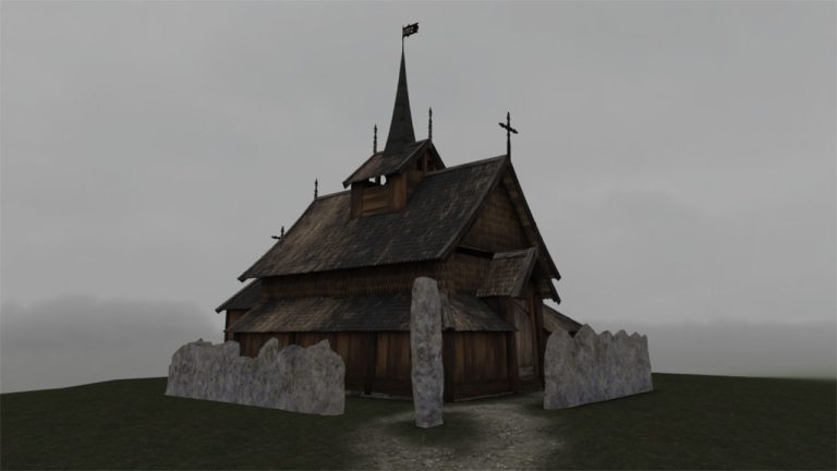
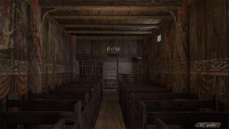
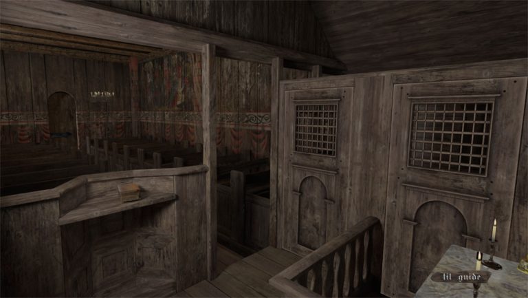
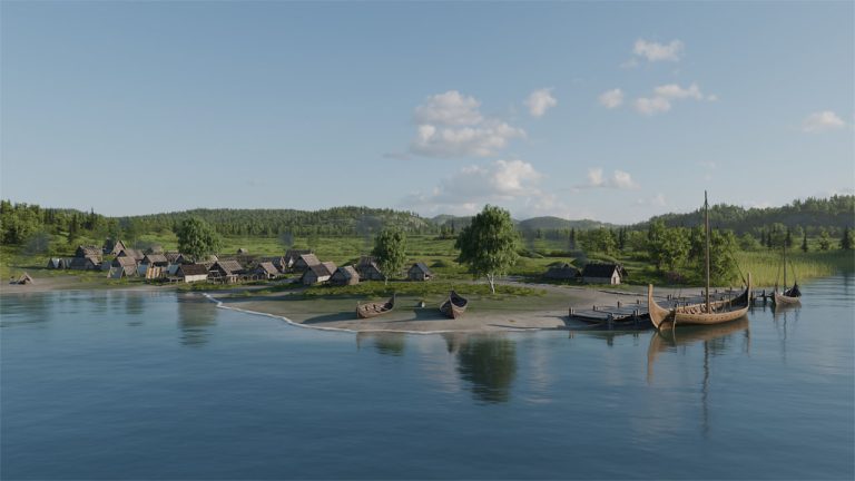
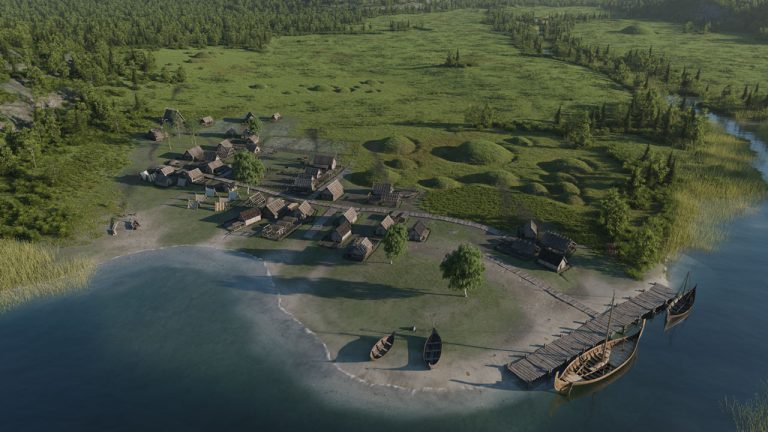
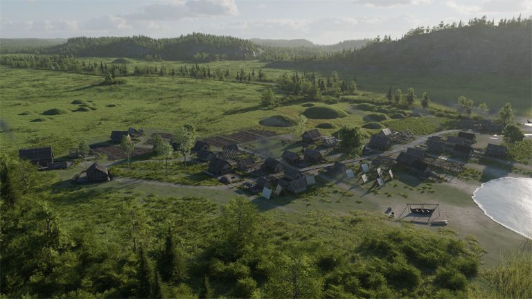
Gåra Stave Church (also spelled Gaara Stave Church) was a medieval stave church that once stood on Gårahaugen near Bø in Telemark. The church, mentioned in sources dating back to the 14th century and likely considerably older, was demolished in 1850 after centuries of use and gradual decay.

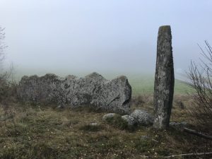
The stones that still remain at the church site. Photo: Rune Nordseter.

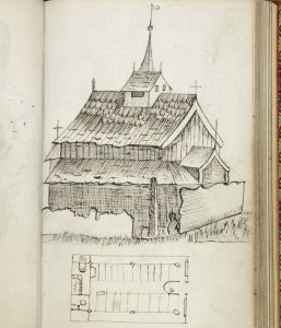
Fortunately, the church left behind a rich body of sources: early travel sketches and diary drawings made by Andreas Faye in 1824 documented the church’s form, dimensions, proportions, and construction details. These sketches were later published in contemporary articles and have since served as a central reference for historians and cultural heritage enthusiasts.

Due to the detailed documentation from the 19th century and a small number of preserved objects, scholars have been able to develop interpretations and visualizations of how the stave church once looked. Faye’s sketches provide unique insight into the structure and architecture of the building, which would otherwise have been lost along with the church itself.

Building on this foundation, we have developed an interactive 3D model of Gåra Stave Church. The model allows users to move freely around and inside the church, much like in a game or a VR environment. It is based on Faye’s historical drawings from 1824, supplemented by interpretations of construction methods from contemporary churches and the few surviving objects associated with the site.

The aim of the model has been to create a vivid experience of a lost cultural heritage site, where architecture, spatial qualities, and details are reconstructed as faithfully as possible within the limits of the available source material. In this way, it allows both specialists and the general public to explore an important, yet physically lost chapter of Norwegian church history—200 years after the first sketches were made.

Link to the 3d model: https://v3d.net/v5h

LMB - Liquid Methane Bunkering Vessel

The 3D construction of the LMB (Liquid Methane Bunkering Vessel) was developed for CGR Arctic Marine as an interpretive, technical visualization of a specialized vessel designed for the safe and efficient bunkering of liquid methane. The model presents the main structure, deck layout, and key components, and is used as a basis for design evaluation, communication, and further development of the concept.

20.02.2021

LNT Marine | A-Box system

LNT A-BOX® is a cargo tank system for liquefied gases such as LNG, LPG, and ammonia, developed by the Norwegian technology company LNT Marine. The system consists of self-supporting IMO Type A tanks installed in an insulated cargo hold with a full secondary barrier, providing safe, efficient, and flexible storage of cryogenic gases on board. The solution was developed throughout the 2010s and commercialized around 2019, following the achievement of Approval in Principle (AiP) for large capacity. A-BOX® is designed for straightforward construction, efficient maintenance, and high volume utilization, enabling gas carriers to be built at multiple shipyards at lower cost.

01.02.2020

Cavediving 3D experience

This is a simple 3D simulator that runs in a web browser on your PC or Mac.
This was created to test navigation in different environments, where both composure and spatial orientation are put to the test.

03.01.2020